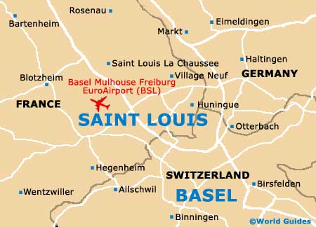
Basel Mulhouse Freiburg EuroAirport (BSL)
City Orientation and Maps
(Saint Louis Cedex, France)
Saint Louis enjoys a scenic position on the eastern side of France, in the province of Alsace. The city is especially close to the border of both Germany and Switzerland and is based around the eastern banks of the River Rhine.
Surrounded by a number of main roads, the city is near to the A-35, making Saint Louis easy to reach from all over the country. Paris can be reached in less than five hours by car, being situated directly west of Saint Louis.
Basel Mulhouse Freiburg EuroAirport (BSL) Maps: Important City Districts
Close to the city, Strasbourg is sited around 130 km / 80 miles to the north of Saint Louis, with a journey time of around one and a half hours. Also worth noting, Mulhouse is a mere 32 km / 20 miles to the north-west, a car journey of approximately 30 minutes.
France Map

Saint Louis Map